Established in 1993, the Mugs Stump Award provides funding to North American individuals and teams who propose exceptional climbing objectives–a first ascent, significant repeat, or first alpine-style ascent. The award was created in honor of American alpinist Mugs Stump, who was killed in a crevasse fall while descending the south buttress of Denali in 1992. Stump put up routes all over the world, but is best know for his first ascent of Mt. Robson’s Emperor Face, the east face of the Mooses Tooth and a solo speed-ascent of Denali’s Cassin Ridge: a record that has yet to be broken.
“Mugs saw climbing differently than many of his contemporaries, as a spiritual and mind-expanding quest,” said award co-founder Michael Kennedy. “He wanted to push his personal limits and to stretch what we all saw as possible. He was one of the first people to really embrace the ‘super fast and super light’ approach.”
In this spirit, award recipients are climbers who best exemplify Stump’s alpine-style and leave-no-trace philosophies as well as reflect the values he embodied: humility, boldness, purity and simplicity, Kennedy said.
The 2010 Mugs Stump Award recipients attempted an array of bold objectives, from first ascents on obscure peaks in Tibet and Greenland; to new routes on well-known faces in the Central Alaska Range. Whether teams ultimately reached success or failure, each enterprise was undertaken with the same style and audacity as the award’s namesake.
Please visit mugsstumpaward.com for more information on the award, to apply, and to read trip reports from past recipients.
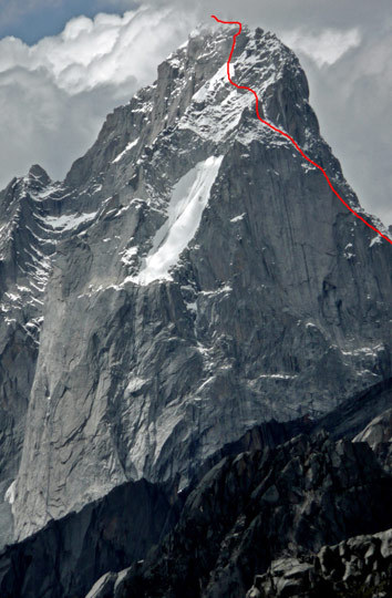
Headwaters (5.10 A2 M5 80 degrees, 1000m), east face of Seerdengpu, Sichuan, China. Dylan Johnson and Chad Kellog completeded the mixed route in alpine style on September 13, claiming the first ascent of this 5592-meter peak. [Photo] Dylan Johnson
Americans Bag Sought-After Summit in China
On September 13, Dylan Johnson and Chad Kellogg reached the long-sought-after summit of Seerdengpu (5592m), which has attracted around a dozen attempts over the past decade.
Seerdengpu, translated as the “Savage Peak,” forms the high point of the Changping and Shoughshiou River Valleys. A 1600-meter granite wall makes up the mountain’s north and west faces, which are “incredibly accessible”, reached by bus and a couple hours walk. The 1200-meter south and east aspects are much more remote and provide a combination of big walls and “complex” alpine mixed terrain, Johnson reports.
The pair arrived in the area in late August and set up an advanced base camp below Seerdengpu’s east face after acclimatizing in the Changping Valley. On September 2-4, Johnson and Kellogg made an attempt on a line up the east face, climbing 250m of 5.10 granite before descending to high camp at 4900m. The pair were stormed on through the night and decided to bail, leaving fixed lines through the crux slabs before returning to base camp.
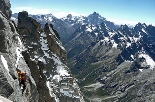
Chad Kellogg navigates an exposed traverse on Seerdengpu. [Photo] Dylan Johnson
They returned to the mountain four days later despite questionable weather and poor visibility, and were pleased to find “straight-forward” snow and mixed climbing up to M5 for 300m above their previous highpoint. At 5200m, the climbers encountered a complex sequence of gendarmes barring their progress. While drytooling a thin crack on one of the gendarmes, Johnson took his “first real alpine whipper” after his ice tool popped off the rock as he searched under the snow for a gear placement. Unnerved by the fall and lacking bivy equipment, Johnson and Kellogg cached their food and returned to high camp.
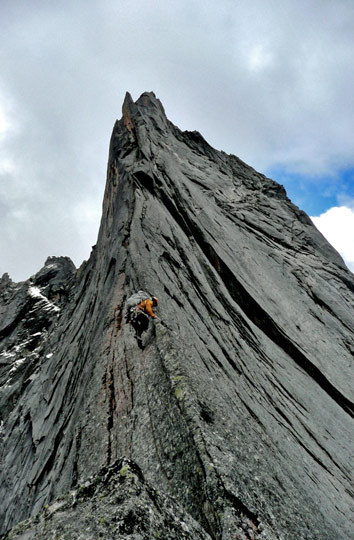
Chad Kellogg works his way up a 5086-meter peak near Seerdengpu in Sichuan, China. Kellogg, with partners John Dickey and Dylan Johnson, bailed off the spire just 25m below the summit. [Photo] Dylan Johnson
The duo recharged for a day at base camp before making the 15-mile trek back to the east face for a third attempt on September 12. They returned to the wall that night, climbing by headlamp and reaching their high point at dawn. This time, they decided to bypass the gendarmes by traversing for four 5.10 C2 pitches to access moderate terrain on the upper mountain. They simul-climbed the remaining 300m to the summit ridge, where easy mixed climbing led them to the summit at 2:30pm on September 13.
Johnson and Kellogg christened their route Headwaters (5.10 A2 M5 80 degrees, 1000m) in reference to Seerdengpu’s position at the apex of the two river drainages and as “an acknowledgement of the alarming glacial recession underway here [which is] a major threat to the crowded Chinese lowlands extending thousands of miles downriver” Johnson said in his trip report.
A day later, the pair joined John Dickey on an attempt to climb a 5086-meter spire near Seerdengpu. The climbers bailed just 25m from the summit when they ran into a steep, “unprotectable” arete well after dark.
Johnson and Kellogg also roped up together in 2008 for the first ascent of Siguniang’s southwest ridge (5.11 A2, 2000m) and the second ascent of a nearby 5670-meter peak in the Changping Valley. For more on these climbs, see the October 15, 2008 NewsWire.
Aartun, Haley Bag Impressive New Route On Foraker
Bjorn-Eivind Aartun and Colin Haley found success during a 37-day trip to the Central Alaska Range this spring. From June 13-15, the pair made a single-push ascent of a steep, unclimbed wall on Foraker’s southeast face, one of the biggest virgin faces in the Central Alaska Range. Their new route, Dracula, includes difficulties of M6R AI4+ A0 and gains 10,400 vertical feet. Read the June 28, 2010 NewsWire for more information on the ascent.
The duo also attempted to break the 15-hour speed record on Denali’s Cassin Ridge that was set by Mugs Stump in 1991. Slowed by deep snow, they summited in 17 hours.
Please see Alpinist 32, “Scared,” for Haley’s honest account of his struggles with fear and loss on Foraker’s precipitous southeast face.
Storms Delay Success On Mooses Tooth For Another Year
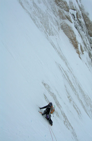
Scott Adamson navigates steep snow slopes low on the east face of Alaska’s Mooses Tooth (3150m). Adamson and partner Matt Tuttle attempted a new route on the sheer face last spring, with the help of the Mugs Stump grant. [Photo] Matt Tuttle
Last spring, Scott Adamson and Matt Tuttle journeyed to the Mooses Tooth Massif in the Alaska Range to climb a new route, in alpine style, on the east face of Mooses Tooth (3150m). The planned route entails almost 5,000′ of steep mixed climbing.
Adamson’s aspirations to climb the east face were born on a 2004 expedition to the massif in which he and partner James Stover climbed a new route on the Mooses Tooth’s south face: Levitation and Hail Marys (V M7 WI6, 3400′). Disoriented by a “ripping” storm at the summit, Adamson and Stover rappelled down a full rope length and found themselves staring down at the wrong wall and the wrong glacier through a break in the storm. They had inadvertently descended the east face, putting the duo on the opposite side of the peak from their base camp. “Back at home I found myself thinking about that wrong turn and how grand and sheer that east face was,” Adamson said. “I had to put a route up that thing… free.”
Adamson and his brother, Tom, returned to the massif in 2008 and attempted the imagined route, which climbed the east face just right of Arctic Rage (VI WI6+ R A2, 4500′, Mahoney-Gilmore, 2004). Halfway up the wall another storm settled in on the mountain. The duo bivied on a cramped ledge for 46 hours, while spindrift and debris washed over them. When the weather broke, they continued up the climb but bailed after reaching a 60-meter-thick band of rotten rock with an unavoidable roof covered in dry, sugary snow and no real ice to climb.
This year, Adamson and Tuttle arrived on the Buckskin Glacier to find the route in excellent condition, with a solid blue ribbon of ice streaking up the face. After establishing base camp and breaking trail across the glacier, the pair embarked on the second attempt. They traded skis for crampons at the bergschrund and quickly soloed and simul-climbed the first 570m of the route before starting to pitch out the terrain. Halfway up the face, a few non-threatening clouds they’d noted earlier in the day turned unexpectedly vicious. They were forced to venture off-route and dig a cave, where they spent the night. Though the snow had stopped falling during the night, heavy spindrift and suspicious-looking clouds convinced the climbers to abandon the attempt and descend.
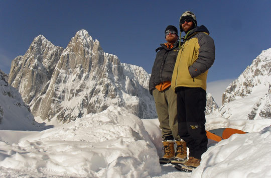
Adamson and Tuttle with the Mooses Tooth behind. [Photo] Scott Adamson
Adamson and Tuttle returned to their objective four days later and made excellent time soloing and simul-climbing to their highpoint. They climbed through a variety of terrain–mixed snice, ice, snow and rock through overhangs and around tight corners–to reach Adamson’s 2008 highpoint at around 750m. This time, the dry snow on the rotten granite overhang was replaced by hanging ice and verglass. The only protection, a slug horn that worked its way off as Adamson lead the steep, pumpy pitch.
“I remember being locked off, throwing for my next stick while the thin ice my foot was on kept skating,” Adamson said. “When it finally caught on an edge my other tool stuck. I took a sigh of relief, looked down and my only gear had come out during the moves… [it was] definitely the hardest climbing either of us had done in the alpine world.”
After about 15m, the ice thickened enough to place a tied-off stubby. Tuttle followed this crux section and they made a few more pitches of progress before the wind picked up, consuming them in a continuous slew of spindrift.
“Our mouths and noses were packed with snow. I had a thick ice crust over my face,” Tuttle said. “We were having a hard time even breathing let alone holding on to our tools.”
The duo pushed through the remaining 90m of technical climbing and faced a “serious” decision. They were only a few rope lengths from the summit ridge, but had left their bivy gear at their previous highpoint to save time and energy. After considering the high avalanche danger, strong winds and dropping temperatures, they decided to bail.
The descent took almost a day and a half, since Adamson and Tuttle were forced to leave one of their ropes after it got stuck. Once they were back at base camp, they had to wait seven days and six feet of snow before a break in the weather allowed them to fly out.
Though they fell short of the summit, the climbers said they consider their trip a success because they now know a free line on the east face might be attainable with a few favors from the weather gods.
Women’s Team Thwarted by Rain in Greenland
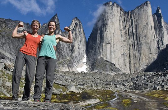
Jasmin Caton and Kate Rutherford show their guns with the twin buttresses of Nalumasotoq, Greenland behind. The pair climbed the 600-meter tower via the British Route (5.12a A0, 600m). They also climbed War and Poetry (5.12a A0, 1000m) on nearby Ulamatorsuaq. [Photo] Kate Rutherford
Jasmin Caton and Kate Rutherford planned a trip to Greenland to climb an all-free route up an unnamed, virgin pillar in the remote Tasermiut Fjord in July. The 1500-meter peak features splitter crack systems up dark, lichen-covered granite. Surrounded by a small, but complicated glacier, the pillar’s technical approach may be the reason it has never been climbed, Rutherford said. Once in the fjord, rainy weather and questionable glacier conditions dissuaded them from attempting the climb. Instead, they climbed two massive towers, Nalumasortoq (600m) and Ulamatorsuaq (1000m), between July 18 and August 6.
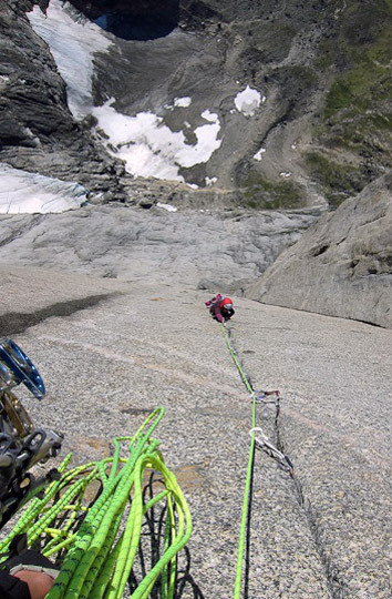
Jasmin Caton follows one of many steep pitches of 5.10 hand cracks on the British Route (5.12a A0, 600m) on Nalumasortoq, Tasermiut Fjord, Greenland. Caton and partner Kate Rutherford also planned to attempt an unclimbed pillar in the same area, but were dissuaded by exceptionally wet conditions. [Photo] Kate Rutherford
Caton and Rutherford tackled the British Route (5.12a A0, 600m) on Nalumasortoq just days after their arrival in the fjord. They made a two-day ascent of the tower on July 19 and 20. The route starts off with a few pitches of 5.11+ before settling into 5.10 hands in a vertical to overhanging corner for 12 pitches. The duo bivied for five hours on a sloping ledge two-thirds of the way up the wall. Exhausted and hungry the next day, the climbers resigned to French-freeing the two 5.12 crux pitches before scrambling up the last two pitches to the summit.
They spent the next 12 days killing time while they waited for rainy conditions to improve. The weather window never opened despite bluebird skies in the forecast. Nevertheless, Caton and Rutherford decided to attempt War and Poetry (5.12a A0, 1000m) on Ulamatorsuaq, the biggest formation they sighted from base camp. The pair enjoyed 15 beautiful and “thought-provoking” pitches of 5.10 to 5.12 slab on the first day and struggled against sandbagged offwidths and chimneys on Day 2. It was “some of the best rock, jamming and suffering of my life,” Rutherford said, reflecting on the two hard-earned ascents.
Sichuan Expedition Cut Short By Injuries
In September, Toby Grohne and Jesse Huey left for China’s Changping Valley with plans to make a light-and-fast ascent of a mixed route on the 1500-meter northwest face of Siguniang (6250m). As part of the same expedition, the climbers also taught a six-day alpine climbing and rescue course to the locals in hopes of forming a sustainable eco-tourism industry in the valley.
As a warm-up for the climb, Grohne and Huey, along with climber/photographer John Dickey decided to attempt a new route on the northeast ridge of Celestial Peak (5413m). The endeavor started off slowly, as the climbers fought their way through a burly approach that Grohne calls “the worst four-hour, 2500-foot vertical… jungle thrashing of all times.”
The northeast ridge is an exposed knife-edge, with the 3,000-foot north and east faces dropping off on each side. Along the way, Dickey filmed and photographed their progress for a documentary by Four Sisters Film. The climbers spent more than 10 hours on the ridge leading and re-leading pitches for the camera and ran short on time despite “trimul-climbing” everything but the single-pitch crux. Forlorn Ridge reaches difficulties of 5.10 at the crux and ascends a total of 3,500′.
After recovering from their Celestial Peak effort, the team set up advanced base camp in the shelter of a house-sized boulder at the foot of Siguniang’s northwest face. They originally planned to climb a route along a rib up the center of the face, but warm conditions raised concerns about loose rock and a lack of snow and ice. Instead, they set their sights on a rock line along the north ridge. During their last night at camp, massive rockfall left their intended line stripped of several pitches. Shaken by the close call but still determined to attempt a new line, Grohne and Huey prepared to attempt their original objective–the northwest rib–and cached supplies at the base of the climb. The next morning, the climbers paused for a bouldering session on a nearby highball. Twenty-five feet off the deck, Huey broke a hold and fell the full length of the boulder, breaking his back and wrist and bruising several ribs.
“I am not sure what was worse, the pain from the broken bones, the realization that I still had to get out of such a remote place or stomaching the thought that it could be a very long time before I would get medical attention,” Huey wrote in a trip report.
Huey fought through the long hike out and an eight-hour jeep ride to a hospital in the town of Chengdu, where he was given three anti-inflammatory pills to tide him over for his flight back to the States. “Mentally, I was taxed. The pain was the only thing keeping me alert to the task of getting out of that valley and getting home,” Huey said.
Though he faces a long recovery, Huey plans to return to Tibet for a second attempt on Siguniang.
Tragedy in the Labuche Kang Massif
Originally planning to make the first ascent of Karjiang (7221m), a “stunning” virgin peak on the Tibet-Bhutan border, David Gottlieb and Joe Puryear had to change plans after the area was closed to climbing due to “border problems.” Instead, they traveled to Tibet to explore the remote and rarely visited Labuche Kang Massif. Only three climbing expeditions to the massif had ever been documented. The apex of the massive range, Labuche Kang (7367m), was climbed just once, via the West Ridge by a Tibetan-Japanese team in 1987. Surrounding Labuche Kang are numerous unclimbed 6000- to 7000-meter peaks.
On September 21, the duo established base camp at 5300m on the south side of the massif on the lateral moraine of an unnamed glacier below Labuche Kang III (ca. 7250m). They spent the next few weeks going on exploratory treks around the valley to scout potential projects. In the first week of October, the pair climbed two 6000-meter peaks to acclimatize before establishing advanced base camp at 5500m. While they waited for high winds and snow to subside, they continued to explore the valley, optimizing their chances of completing an alpine-style ascent.
Gottlieb and Puryear started up the Labuche Kang massif on October 27. At around 5600m, the climbers were approaching the south face on a knife-edge ridge when an accident occurred. Puryear went ahead to scout the route and see how much further they should climb unroped. The knife-edge ridge they had been traversing had debris runnel that cut into the snow, forming a ‘deceptively unstable’ cornice. As Puryear walked across, the cornice collapsed under his weight and he fell. Out of sight and in high winds, Gottlieb did not see of hear his partner’s fall. He climbed up to a section of the ridge where Puryear’s tracks disappeared. After yelling and receiving no response, he climbed to a better vantage point but could not see his partner. Gottlieb then rappelled down the cliff about 250m where he found Puryear’s body at the base in a debris cone.
Gottlieb coordinated a body recovery over the following four days in collaboration with Michelle Puryear, Rajan Thapa of Climb High Himalaya Outfitter, the U.S. Embassies in Chengdu and Kathmandu, Chinese Tibetan Mountaineering Association, and Global Rescue. Puryear’s body was transported to Kathmandu where he was cremated on November 5 at a private ceremony with friends from Nepal and immediate family.