[Photo] Paul Manson
Between October 16 and 24, 2015, Norihide Yamagishi, Paul Manson and I made the first ascent of an unnamed 5207-meter peak on a self-supported expedition to the remote Gangga Range in western China’s Sichuan Province. This spectacular region on the eastern edge of the Himalaya was brought to my attention by Japanese alpinist and explorer Tamotsu Nakamura. Nakamura made dozens of expeditions into the Sichuan ranges over the last two decades, documenting numerous unclimbed peaks and mapping the area’s mountains.
[For more information, read Nakamura: Sichuan’s Most Outstanding Unclimbed Peaks in this Alpinist.com Feature from 2010–Ed.]
We believe ours is only the second of forty 5000-meter peaks in the area to be climbed. “Only one peak–Tsala Mashu Ri (5160m)–was ascended by a Spanish party in April of 2013,” Nakamura says. To our knowledge, the only other attempt was a previous trip I made with other partners in 2014. We failed to summit because of team problems.

[Photo] Tamotsu Nakamura
Following a two-day drive from Chengdu, we set out from a trailhead at 4200 meters with nine days of supplies. We brought neither porters nor pack animals, carrying all of our food and equipment ourselves. Our team approached the peak by a valley that nomads use to descend to their winter homes beside the Yalong River.
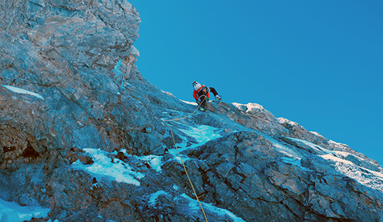
We set up a high camp at 4900 meters, within 100 meters of the north face of Peak 5207. After various high scrambles to acclimatize and view route options before our first attempt, we climbed five pitches of seventy-five degree M6 ice with below-average protection. Yamagishi fell twice here, and lost an ice tool, before we turned back.
Our second attempt took a meandering line of easier M4, and exposed traverses, to reach the obvious central couloir. Once there, we were surprised to find that rather than leading to a summit ridge, the couloir finished at a corniced notch between vertical towers at around 5150 meters. We chose to turn back at nightfall and descended by eight rappels to get back to the moraine.
After a rest day, during which we experienced the only bad weather of the trip, we made our third attempt of the peak. We decided to follow the same meandering line as before, but this time crossed the central couloir, then traversed exposed snowfields along the base of ascending buttresses. From there we made our way to the summit via a short corniced ridge, topping out around 12:30 p.m. We spent twenty minutes recording topographical information to compliment Nakamura’s earlier data, then descended to our previous rap route, and from there to the base of the wall.
We named the mountain Asura Peak after considering the mountain’s many distinctly different aspects and asymmetry. Asura is a Buddhist deity that inhabits the next world above humans and appears in different forms depending on one’s perspective. Dozens of future routes exist on the peak’s north face, while the southern aspects remain almost totally unexplored. Our trip was based on the idea of first ascents done without support, with a focus on minimalism–a style that holds enormous potential for future climbs in the Tibetan ranges.