“[A]s the central Alaska Range fills up with people every spring, with folks complaining about over-crowding and permitting, the Hayes Range still remains an area where often only one group can be found on a whole glacier system,” says Fairbanks climber Jeff Benowitz, who once climbed partway up the South Buttress route of Mt. Hayes to retrieve $100 worth of ice screws abandoned by a group of doctors. “[T]here is still endless new routing to be done.”
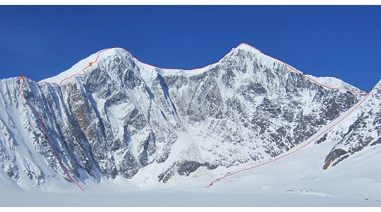
This April, John Giraldo, Jason Stuckey and Angela VanWiemeersch traveled to the Hayes Range, which Mike Litzow described in the 1997 American Alpine Journal as having “…some of the most spectacular mountains in North America,” with their eyes on the east face of 13,832-foot Mt. Hayes. In an area known for its ethic of underreporting, the three established a variation to the South Buttress route, whose first ascensionists remain in obscurity, climbing more than 3,000 feet of new terrain along the northeast aspect to the established route and then on to the summit. “The south buttress has been climbed countless times from the Susitna and Turkey Glaciers,” says Benowitz, but theirs is the only recorded ascent via the Trident Glacier. What follows is Stuckey’s report of the ascent.
On a clear day in Fairbanks you can see all of the big peaks in the Hayes Range–Deborah, Hess, Moffit, McGinnis and Hayes, the tallest. I had explored the Delta Range to the east and the Central Range to the west, but had only touched the edges of the Hayes Range during a handful of trips into the eastern portion, skiing in from the road. After six years of staring at these mountains from afar, I was ready to explore farther into their heights, and on April 19, John Giraldo, Angela VanWiemeersch and I flew out of Delta Junction and into the west fork of the Trident Glacier, below the 6,000-foot east face of Mt. Hayes.
After establishing base camp we headed up glacier looking for lines. An hour of skiing later we felt no closer to the face, a reality that gave us all an idea of how big it really was. The next two days were spent scouting and packing; Angela led an M5 pitch on the left side of the face while John waited out a stomach bug, and the three of us glassed the face, finding the best lines disappointingly threatened by sercas. Finally, we settled on a route on the far left of the face, the northeast aspect.
On the morning of April 22 we were up at 4 a.m., heading up through steep snow and encountering a pitch of 5.8 and several AI3 pitches before Angela was stymied by a rockband surrounded by steep cliffs. To get us through the rockband, John ended up leading a slabby M5 pitch.
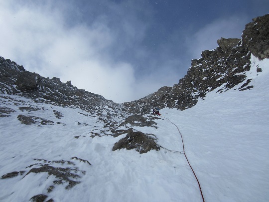
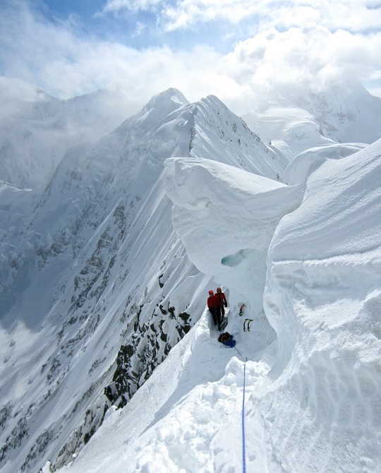
As it got late, I began to worry about finding a bivy spot before dark–we had planned on digging a snow cave or finding a crevasse so we had no tent. I led a couple of pitches of AI3, and an AI4 pitch by headlamp, putting us close enough to ridgeline for John to head up and over for a look. He quickly returned. The knifeedge ridge with hard-packed snow was no good. Settling for an accumulation of snow below a giant cornice on the ridge, we dug out a narrow trench and the three of us brewed up, ate dinner and settled in.
The next morning on the ridge I was immediately met with high winds, typical of the Hayes Range. I placed pickets and ice screws until I ran out of gear, and we regrouped to discuss the weather. The sky was filled with low clouds, and at times it was hard to see the heavily glaciated slopes of the south buttress. If we reached the south summit, retreat would still be a lengthy proposition. I was worried the weather wouldn’t hold, and the fact that we would only have a day and a half of fuel left after reaching the summit imparted a strong sense of urgency to get up and off this mountain. After some discussion, we all decided that we wanted to continue upward.
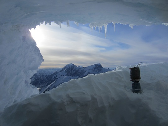
I led the rest of the ridge to where it met the glaciated slopes of the south buttress. John continued through some seracs, which made route-finding slow, before Angela took over, crossing some giant crevasses on thin snow bridges. I’m pretty sure she had her fingers crossed, hoping that they wouldn’t break as she tiptoed across. I know I had mine crossed. That night, after more weaving through crevassed slopes, we settled into an ice cave with soft snow–the perfect bivy spot. We rehydrated and replenished calories while looking out over Mt. Moffit and Mt. Shand.
From here, retreat would be difficult at best, and I kept one eye constantly on the weather as we started to climb the next morning. I’ve experienced the fury of the wind in the Hayes Range on several occasions, and the last thing I wanted was to be stuck on the summit plateau in a storm. We had climbed 6,000 feet of elevation over 1.5 miles at this point and still had another 4 miles and 1,300 feet of elevation to gain, plus 7,400 feet to descend. Lucky for us, the snow conditions were perfect, and it only took us an hour to cross the plateau.
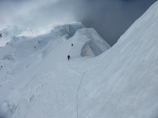
Angela led across the bergschrund, up the summit slopes to the summit ridge and finally to the top. Snapping a few photos, we quickly began our descent–clouds had come in, and it had started to snow lightly. Visibility was low, but I knew the general direction of the east ridge so we headed that way. Angela and John were a little worried as we headed down into the cloudy abyss, but I assured them that we were going the right way. It’s a ridge, right? We couldn’t get lost.
We spent the next few hours downclimbing thousands of feet of steep snow and ice faces, route finding and rapping over giant crevasses. We reached the glacier again, 72 hours after we had begun, naming our new route Thicker Than Thieves (VI 5.8R AI4 M5, 7,300′). As we skied back to our base camp, a strong wind began to blow out of the west, with gusts large enough to make us stumble. Glad to be down safely, we spent the next day hanging out in our tent, happily drinking scotch and playing Yahtzhee as the winds raged outside.
Sources: Jeff Benowitz, Jason Stuckey, 1997, 2004 AAJs