[Photo] Rachel Spitzer
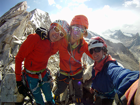
This summer, when Rachel Spitzer, Lisa Van Sciver and I traveled to the Zanskar region of India, we could find few maps for the local mountains. The one that we used appeared to have incorrect information.
Equipped with a small photo of a peak from an article, we headed into the Dalung valley, the first of five valleys west of Pensi La (4485m).
Traveling south by bus from Ladakh, in Leh, India, we arrived to the vast Zanskar region on August 24. Zanskar, in the eastern part of Jammu and Kashmir, a historically conflicted border region, contains vast peaks, deep valleys and several villages. For fourteen hours we followed a windy road paralleling the Suru river. After the bus dropped us off, we loaded five horses with our equipment, crossed the wide Suru River and ascended a steep moraine to establish base camp 25 kilometers from the Buddhist village of Rangdum. Eventually the horses were unable to continue because of the sharp rocks that littered the moraine, so we unloaded our gear at an altitude of 4265 meters about two miles up canyon.
Soon after arriving, we realized we were in the wrong valley–our intended peak was nowhere in sight.

[Photo] Anna Pfaff
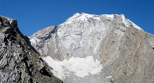
Unwilling to repack our gear and seek out our primary objective, likely located in a parallel valley, we spent the following days hiking around the surrounding area searching for a new climb. During our reconnaissance, we discovered several worthwhile objectives and settled on an unclimbed massif we named Tare Parvat (5577m)–Hindi for Star– which divides the Dalung and Chilung Nala valleys. [Nala translates to small river–Ed.] We chose the objective because of its majestic cirque feature, mixed climbing terrain and direct approach.
On September 5 at 4 a.m., we left our high camp at 4876 meters and hiked under darkness, our vision illuminated by headlamps and stars. Soon we heard a loud cracking sound and took cover under nearby boulders before realizing it came from cracking ice. We giggled sheepishly and continued up the talus slope to access the start of our new line.
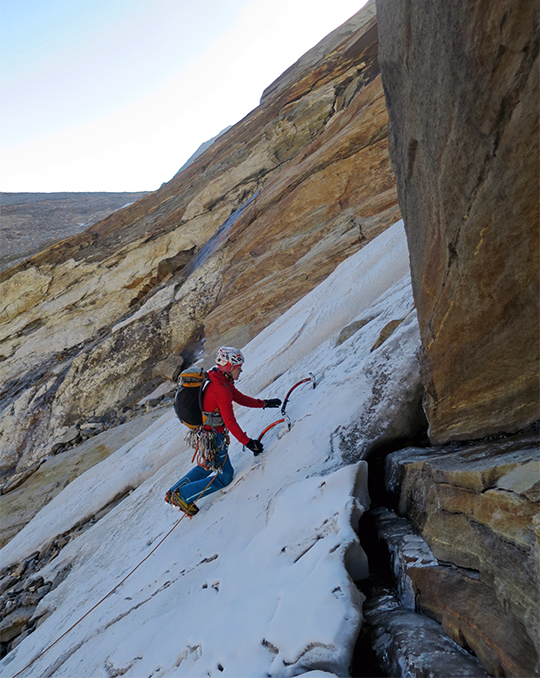
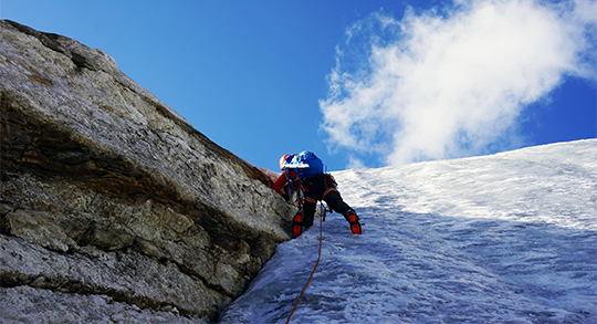
Starting up the route, we found thick water ice and moderate mixed conditions. Here we were able to climb quickly, placing only a few knifeblades and ice screws for protection. As the route became steeper, we placed many more knifeblades as they were the best form of protection for the thin seams on our line.
Reaching a prominent ridge midway up the route, the rock quality greatly deteriorated into unattached plaques resting upon one another. Here we took great care to climb a 215 meter section of loose, runout slabs.
Above the slabs, we unroped and maneuvered through third and fourth-class loose blocks for nearly 200 meters. Nearing the summit, we encountered rotten, sun-baked ice.
We named our line up Tare Parvat’s northeast ridge Unattached (5.6 M4 WI3 AI4, 600m), which we completed in alpine style and without bolts in 15 hours from camp.
Merriam Webster Dictionary defines Unattached as “not assigned or committed (as to a particular task, organization, or person).” Since we traveled half way around the world to climb a peak that we didn’t find, then made the best with what we had, we found the name suitable.

[Photo] Lisa Van Sciver
This trip was partially funded by support from American Alpine Club via the McNeill-Nott and Copp-Dash grants. We found it fitting to climb in the same region where Copp and Dash established a great line on the Shafat Fortress. During our trip we met local residents who welcomed us and told stories of Copp and Dash and their charismatic personalities.
[Read the NewsWire from September 14, 2007, on the Jonny Copp and Micah Dash’s Shafat Fortress climb here–Ed.]

[Photo] Rachel Spitzer